Big Bend 2017: No. 2 - Toll Mountain
- Shaun C Tarpley

- Oct 29, 2018
- 6 min read
Updated: Dec 1, 2018
Our three day hike into the backcountry of the Chisos Mountain Range began on a clear desert morning, November 30th, with the soft chirping of birds and the bustle of a few groups starting around the same time. Our packs were heavier than usual due to the dry weather and reports that all backcountry water had dried up, but we were excited about the trail ahead. As the parking lot faded from view, we knew that we were committed to our first long trek through Big Bend.

As we started the 12 mile long South Rim Trail heading Southeast up the Pinnacles Trail, we glanced back at The Window and into the valley beyond. While it was a great view, we knew that it was only a small taste of what was to come out on the South Rim. The first leg of the hike was an arduous 3.5 mile haul up 2000 ft of switchbacks from the Chisos Basin at 5000 ft, up to the TM1 campsite at just over 7000 ft. The late November temperature was surprisingly hot, and the sun still had an oppressive sting. However, it was really the dryness of the desert that made the hike more strenuous. Since we planned to spend 3 days in the backcountry, the Park Rangers recommended that we carry 3 gallons of water each which topped off my pack at around 60 pounds with my usual winter camping and camera gear. Camping in the winter always requires a heavier pack for more layers and a thicker sleeping bag, but hauling all of our own water really made the pack's weight skyrocket.
Everywhere we went in Big Bend, there was a plethora of local flora from the golden Mexican Feather Grasses flanking the path, the ghostly white flowers clinging to the rocky side of the mountain, the spiraling bark of a mossy, Drooping Juniper, to the spiral seedlings of the Blue Grama grass. It made the hike truly enjoyable at every turn, even if it was very steep and grueling on the body.
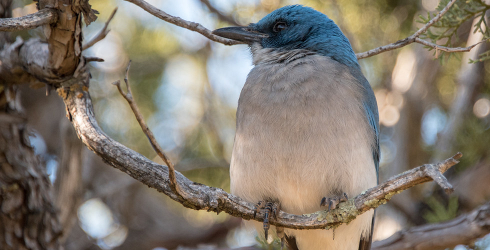
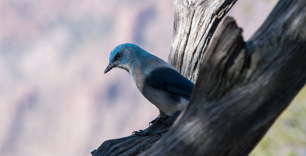
While many people often think of a desert as a dead environment where nothing grows or survives, the Chisos desert is in fact teaming with life. A huge assortment of birds thrive in the high, mountain ecosystem and they were a constant point of interest. The Mexican Jay isn’t seen anywhere else in Texas other than around the Big Bend region. We were fortunate that a few Mexican Jays were taking shelter from the heat in the trees above our campsite and were not particularly bothered by us. The Nikon 28-300mm f3.5-5.6 lens I used for this part of the trip is great as an all-in-one lens, but the far end of the telephoto range is a little short for birding. Fortunately, the Mexican Jays weren't too skittish and they let me sneak up closer than most birds allow.
The hike up the Pinnacles trail was exhausting, especially while hauling the maximum weight for the trip on our backs, but it was a choice we made early on while researching the many routes available (though prior to knowing how much water we would need to haul). While this direction around the South Rim is more challenging, it was the fastest route to a nice campsite that had a good view, and it allowed us the best introduction to the South Rim scenery. As we summited the 7000 ft saddle between Emory Peak (the tallest point in Big Bend) and Toll Mountain, the entirety of the Chisos Basin opened up before us. We sat on the warm rocks and watched the shadows of the rim stretch long across the basin as the sun dropped ever lower in the sky.

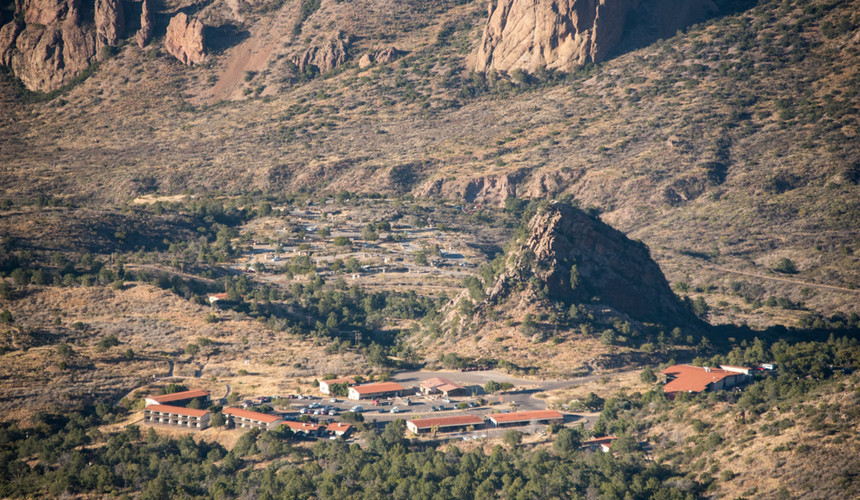
Travis had a great pair of binoculars that we used quite often while on the trip. They were so sharp that we could see our campsite in the basin from over 3 miles away. From the ridge, we could easily see for about 20 miles out to the horizon, and nearly 4000ft down, to the desert Northwest of the basin. The haze of miles of atmosphere between my 300mm zoom lens and the mountains near the horizon distorted the color of the landscape, so I decided that a monochromatic image would be more interesting as it accents the texture and detail of the desert without allowing the color to distract.

TM1 is a great campsite that is a solid hike up Toll Mountain adjacent to Emory Peak. It is well isolated from the main trail, and the view is fantastic. We picked this site in order to hike up Emory Peak before the next day's hike to the rim, but with my existing back injury, and all the energy it took to hike the extra 25lb of water up The Pinnacles, we decided to enjoy the view, make a good meal, and leave the peak for another trip.
Generally, you can expect the temperature to drop around 5.4 degrees Fahrenheit for every 1,000 ft of elevation gain. However, if it is cloudy, raining, or snowing, the drop may reduce to only 3.3 degrees as excess water vapor in the air generally leads to a slower transition in temperature. Water has a very high specific heat which means more energy is required for the environment to increase or decrease the temperature of water in the air. While generally helpful, these estimates aren't always accurate, as we unfortunately discovered on this trip.
Travis brought his Big Agnes Copper Spur UL2 on the trip so we split up the weight in our packs. It is an incredibly light tent, and it provides just enough room for two people and a few extra items. For backcountry camping, a light but effective tent is a must. While the tent was light, we hiked up some heavier sleeping bags and clothing since we expected for the increase of 2000 ft, and the exposure our campsites, to drop the temperature at night into the high 20s instead of the low 40s that we had experienced in the basin.
However, even though the air felt dry, we did not experience a noticeable temperature drop between the two elevations and it almost felt warmer in the highlands than it had in the basin. It is possible that we just happened to head out at a time when the temperature increased, but I didn't have a solid forecast for the mountains so I can't say for certain. Needless to say, I definitely overheated in my 0 degree bag, and I cursed the extra weight I had to haul just to sweat out a night. I have a hyper-light 45 degree bag that was comfortable in the basin with a liner, and likely would have been plenty for the backcountry, but it's always hard to balance sleeping bags with anticipated temperatures as the comfort level for each bag covers such a small range of temperatures. A hot night is uncomfortable, but so is a freezing night. A few nights after we left Big Bend, it dipped into the teens and snowed (a perfect temp for my 0 degree bag), so picking gear for the backcountry is always a gamble when you will be out for multiple nights.
After setting up camp, I hiked a little further up Toll Mountain and found a rocky outcrop that provided a unique view into the Chisos Basin. The campsites, hotel rooms, and visitor center felt much farther away than the 3.5 miles we hiked, even though we were likely only 2 miles away as the crow flies. The steep cliff at the edge of the outcrop provided a great sense of depth as I dangled my feet off the edge.

Death is a natural part of the desert, and it is essential for new growth in this harsh environment. Cactus is common, even this high in the mountains, but when it dies it leaves a ghostly skeleton of internal veins that once helped transport and store water within the cactus.

Agave are also plentiful in Big Bend and they are a decent source for water in desperate times. The serrated teeth along the sides of the agave leaves are a risk, but the true danger lies in the dark needle at the end of each leaf. One wrong step can very quickly leave you with a puncture wound as the thorn can easily penetrate even heavy garments, much less the light-weight hiking clothes we were wearing.

Dusk descended slowly on Toll Mountain, and the day's final rays of sunshine streamed across the Northern face of Emory Peak. The first day of backcountry camping slowly came to a close, but the setting of the sun wouldn't exactly leave the Chisos Mountains to the cover of darkness.

The waxing gibbous moon was already high in the sky by the time the sun went down, and given that the moon was nearing perigee, it provided enough light that we didn’t need our headlamps to see around our campsite. While beautiful, the bright moon created considerable glare in the sky so the starscape was noticeably veiled compared to the skies I have seen in the Chihuahuan Desert on a moonless night. The clarity of the Big Bend sky, and the lack of terrestrial light sources, allowed for a surprisingly clear shot of the moon using my 28-300mm zoom lens, hand-held, utilizing a trekking pole as a pseudo monopod.

We only planned to stay at the TM1 campsite for a single night, so we went to bed soon after the sun set. However, the moon remained high and bright in the sky very nearly until the sun rose the next morning, making sleeping a bit of a challenge.
© 2017-2018 Shaun C Tarpley


Comments